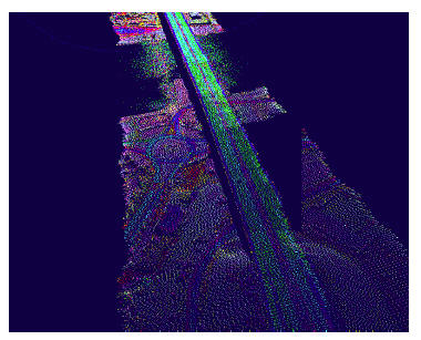
This is among the most interesting applications of LiDAR data. A helicopter bound LiDAR sensor is generally used for mapping of corridor by flying at lower altitude for collecting accurate and dense data of corridors. A corridor may be highway, railway or oil and gas pipe line. The data are useful in planning the corridor and during execution of work and later for monitoring the deflections, possible areas of repair etc. High density of data facilitates generation of a record of the assets of the corridor.
Figure 25: A highway corridor captured using LiDAR data