LiDAR accuracy is generally stated in vertical direction as the horizontal accuracy is indirectly controlled by the vertical accuracy. This is also due to the fact that determination of horizontal accuracy for LiDAR data is difficult due to the difficulty in locating Ground Control Points (GCPs) corresponding to the LiDAR coordinates.
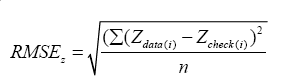
The vertical accuracy is determined by comparing the Z coordinates of data with the truth elevations of a reference (which is generally a flat surface). The accuracy is stated as RMSE and given by:
LiDAR accuracy is reported generally as 1.96 RMSEz. This accuracy is called fundamental vertical accuracy when the RMSE is determined for a flat, non-obtrusive and good reflecting surface. While the accuracy should also be stated for other types of surfaces, which are called supplemental and consolidated vertical accuracies.