IRS-P4 OCM data has been found useful for change analyses. Ocean parameters
for the state of Orissa and adjoining parts of Bay of Bengal. IRS P-4 OCM
payload is optimally designed for estimation of chlorophyll and suspended
sediment in coastal waters. The payload consists of 8 narrow bands out
of which 6 are in the visible spectrum and two in the NIR (near infrared)
region. The large spectral channels in the 8 band also facilitate devising
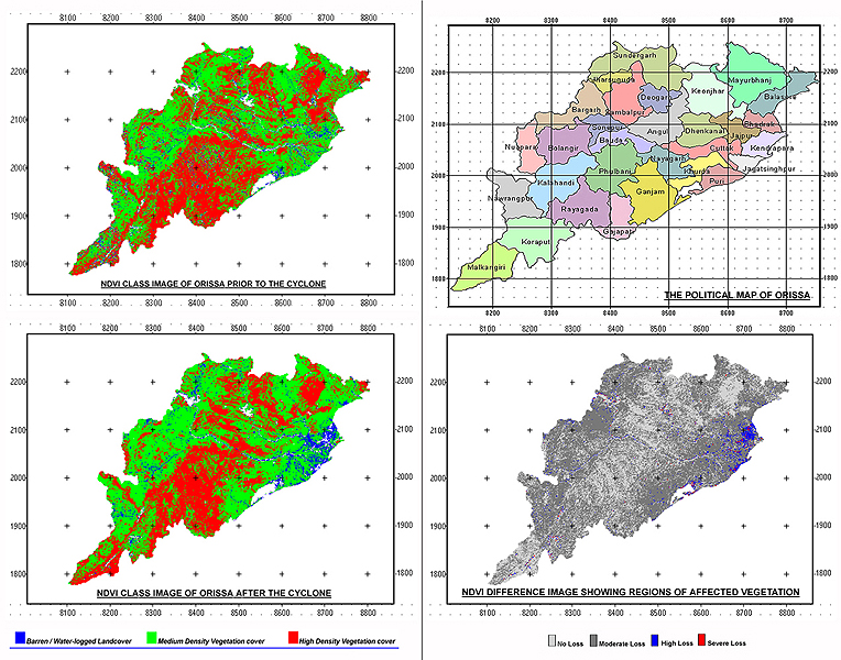
land indices like NDVI, which is helpful in change analysis. The super
cyclone that hit Orissa on Oct, 27th, 1999, has brought drastic changes
widely through out the coastal districts and in order to monitor the changes
that occurred before and after the event. The current study has been done
using the IRS-P4 OCM (Ocean Colour Monitor) imageries. IRS-P4 is the first
in the series of operational ocean remote sensing satellites and was launched
by PSLV on 26th May, 1999. The field of view of the optics is 43 degrees
providing a swath of 1420 km from 720-km altitude.
VEGETATION CHANGE ANALYSIS
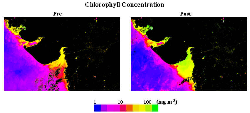
COASTAL WATER CHLOROPHYLL ANALYSIS
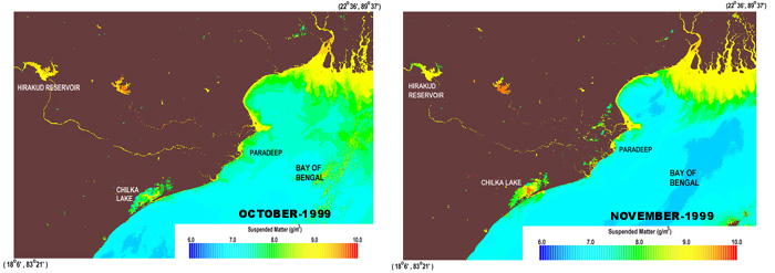
COASTAL WATER SUSPENDED MATTER ANALYSIS