Im a student of cartography in Technical University Dresden, Germany.
As a part of our studies, we have to do a four-month practical placement in - if possible - a foreign non-German speaking country.
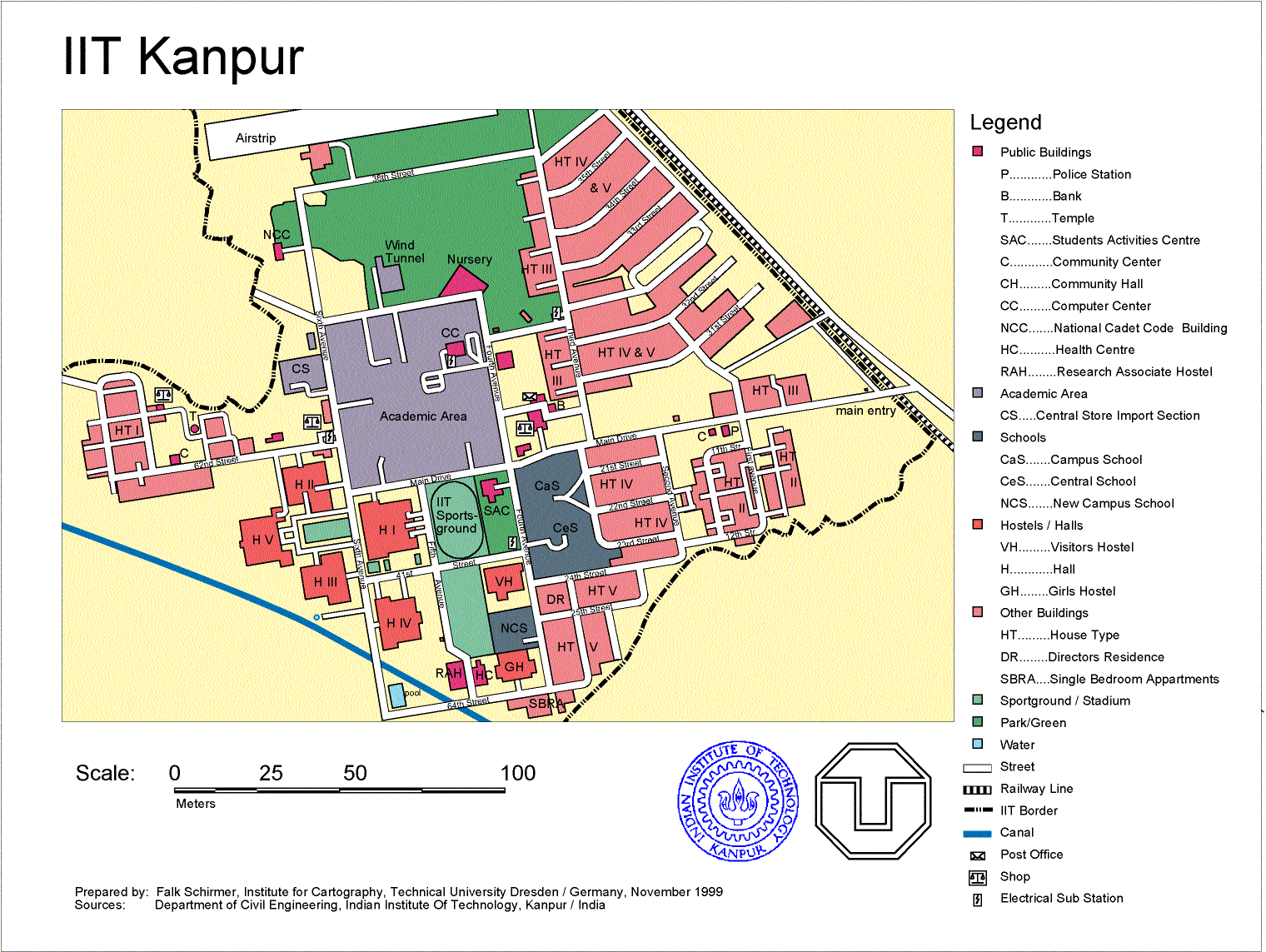
I have chosen India.My job here was to create different maps, to show how a visualization of geodata should look
like.Firstly, I used a rectified IRS-MSS image as background for getting the geometry of the IIT campus
area.
The classification was done manual, by the use of different already existing maps, after the
information of the image was enhanced with the help of Adobe PhotoShop-software.Pict. 1: Map of IIT Kanpur
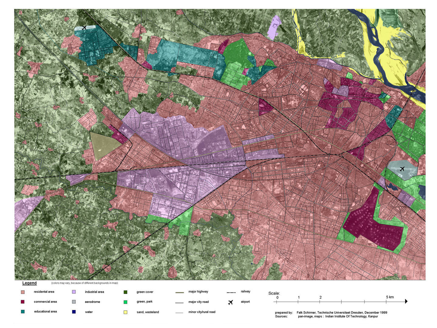
Secondly, I made a map of the whole Kanpur area with the same features.
The next, third, project was to create a satellite image map of the same area, but using IRS
1C-PAN data with a much better resolution.The used package was MapInfo, a GIS-software, that was completely new to me. After learning
about its functions, I used transparent colors for showing the type of areas. Again, classification
was done with help of existing land-use maps. Above this classification, I added the linear
elements, like streets, railway, and rivers the problem was to find a layout, that is not too big in
size, but has a resolution that is good enough to recognize some details. This is also the reason for not adding names or other explanations to the image. The final version will be printed in A3 size.
The version presented here is reduced in size.