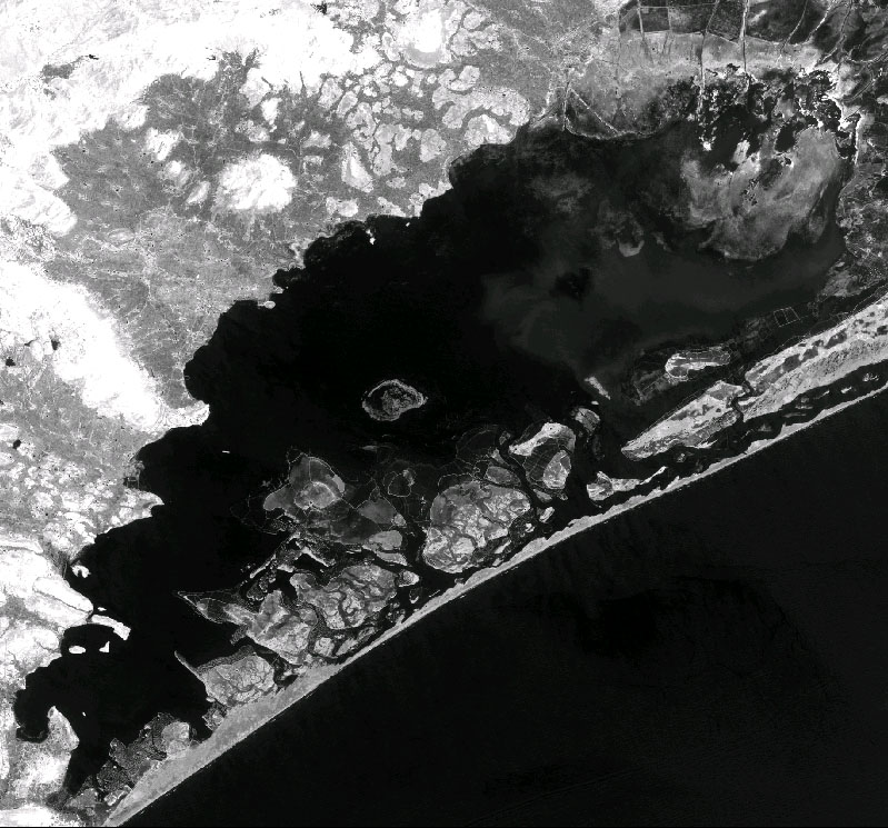
Figure 1
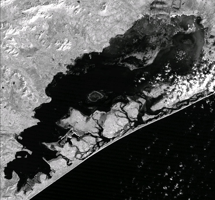
Figure 2
The LANDSAT Thematic Mapper Data of the Chilika Lake for 1989 and 2000
have been analysed. The two images (Figures 1 and 2) generated from the
data clearly indicate the shrinkage of the lake (emergence of land) in
the western and the north-eastern sides. The shrinking of the lake in the
western part is because of the silting made by the rivers flowing from
the Eastern Ghats. In the north-eastern side, numerous islands have been
emerged which are made up of silt and sand-dunes carried out by the offshore
long current from the Bay of Bengal. The emergence of the new islands is
constantly choking the 100-meter long mouth of the Chilika Lake to the
Bay of Bengal. So, there is always a problem for discharge of the silt
to the Bay of Bengal which were carried out by the rivers from the Eastern
Ghats. In last 10 years, the area of the Chilika Lake has already been
reduced by approximately more than 200 km2. So, close monitoring of the
Chilika Lake must be done and appropriate environmental measures should
be planned to save this dying lake from the siltation.
|
Figure 1 |
Figure 2 |