Vol. 29 No. 4
|
Vol. 29 No. 4 |
|
|
|
|
|
|
|
|
S. Anbazhagan and E. Saranathan | Structure and its Impact in Uthangarai & Thithamalai Region, Tamilnadu Using Remote Sensing |
|
|
|
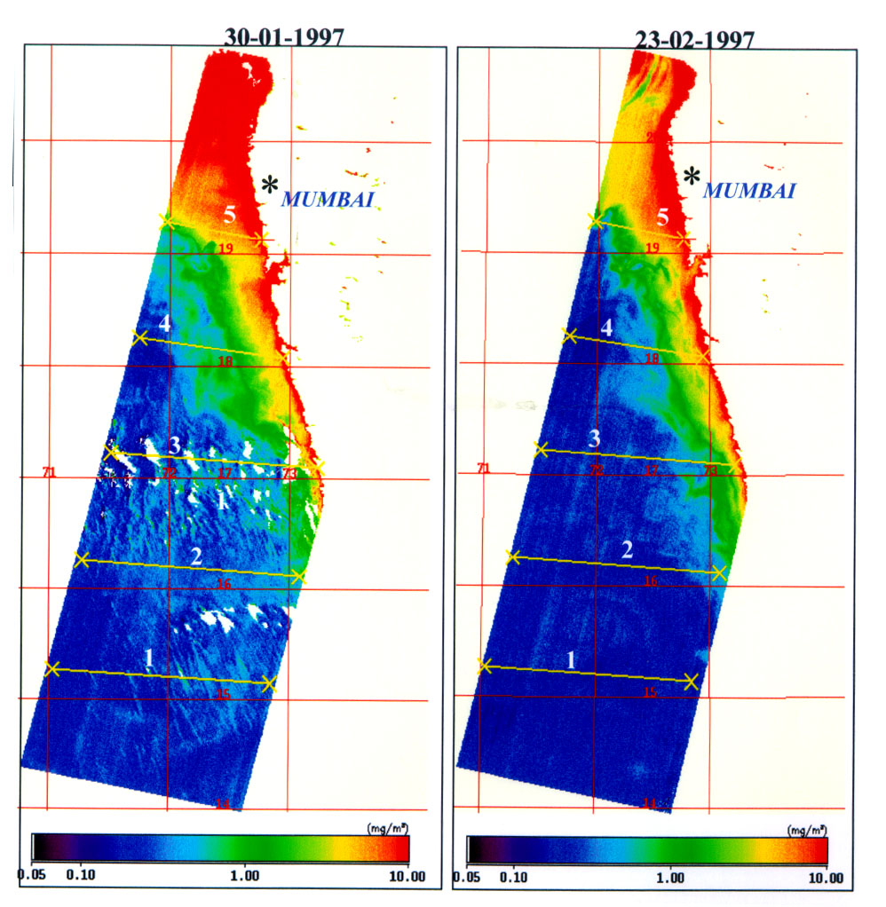
R. K. Sarangi, Prakash Chauhan and Shailesh Nayak | Chlorophyll - A Concentration Along West Coast of India Using IRS-P3 MOS-B Data |
|
|
|
K. Ganesha Raj, M. A. Paul, V. S. Hegde and R. Nijagunappa | Lineaments and Seismicity of Kerala – A Remote Sensing Based Analysis |
|
|
|
R. D. Doi | Vegetational Response of Rainfall in Rajasthan Using AVHRR Imagery |
|
|
|
Shishir Raut, K. S. Sundara Sarma & D. K. Das | Evalution of Irrigation Management in a Canal Command Area on Agrometeorological and Satellite Remote Sensing Data |
|
|
|
A. K. Mandal & R. C. Sharma | Mapping of Waterlogged Areas and Salt Affected Soils in the IGNP Command Area |
|
|
|
Dr. M.A. Mohammed Aslam and A. Balasubramanian | Identification of Palaeochannels Around Cauvery river Near Talakad, Karnataka Using Remote Sensing Data |
|
|
|
Sudhir Mahajan, Pankaj Panwar and Deepak Kaundal | GIS Application to Determine the Effect of Topography on Landuse in Ashwani Khad Watershed |
|